Showing posts with label Central Fells. Show all posts

Friday, 3 April 2015

Blea Rigg via Easdale Tarn


I think of Grasmere as being the heart of the Lakes, Right in the middle, accessible from Keswick or Windermere, Coniston or Patterdale, it stands to reason that it is a busy little village. 


With it's literary, culinary and cultural links, it attracts far more than just your hardened walkers which means that although the village might seem bustling with activity, once you get out and about things quieten down - unless you follow the crowds up Helm Crag.


This walk took us up the popular scenic walk to Easedale Tarn, alongside Sour Milk Gill. The weather was not great and this probably deterred a number of people from heading upwards and so the route wasn't too crowded.


The walk up to the tarn is postcard picturesque all the way, with amazing views from the valley floor, along the gill and up to the edge of the tarn.


At this point the weather took a turn for the worse and as we started heading up the path to Blea Rigg the rain and mist set in, so the views were pretty minimal all the way to the top. The climb itself is good fun, with the path crossing rocky terrain before making the final sweep to the top.


As luck would have to the clouds started to dissipate when we were on the rocky summit, giving us glimpses of fell groups all around such as the Langdale Pikes and the Coniston range. The rain also subsided and conditions became very favourable.


From Blea Rigg we followed the well-trodden path towards Silver Howe, stopping en route for a picnic. We enjoyed our food whilst taking in the view over Grasmere towards the Fairfield horseshoe.


We got as far as the summit of Raw Pike, before deciding to head back towards Grasmere. This was a fairly simple but very rewarding walk and a great way to spend a couple of hours in the heart of the Lake District.


Thursday, 27 March 2014

Grange Fell, Central Fells


Looks like we had a lot of luck this Winter. We did this walk on the 31st December and the day started off quite horribly - heavy rain meant we didn't delay on our drive from Ambleside to Keswick for fear that the roads would flood - some side roads were already closed. We had then resigned ourselves to a day of looking around the shops and spending time in Booths and the Lakeland Pedlar, so all would not have been lost, but by around 1pm a hint of blue appeared in the sky and gradually the rain eased off.


We dashed back to the b&b and grabbed our waterproofs and boots and decided to head into the hills. With only a couple of hours' daylight left we decided to have a look around Grange Fell. After a drive along the Borrowdale road we parked up close to the Bowder Stone and set off. The actual Bowder Stone we have saved for another day. We were lucky to have made it along the road as shortly afterwards the Borrowdale road was closed for repairs.


We followed the route in the AW book, circumnavigating the base of Great End crag and into an enchanted woodland. I don;t tend to think of the Lakes in terms of ancient woodland but here and there you enter pockets of trees and it becomes very other-worldly - this walk is no exception as you climb the steep steps through the woods. Easy going up but a bit treacherous coming down!


Every now and again we stopped to catch our breath as the climb was very steep, and to turn around and enjoy the vista over Derwentwater that was opening up behind us.


Eventually the path levelled off, and we were on the rather lovely higher ground of Grange Fell. It is hard to spot a definitive summit and indeed there are a couple to choose from, strewn across the rocky studded ground.


Despite Wainwright's words imploring us to head up King's How to take in the views, time was not on our side and so we headed across the soggy ground to the Brund Fell summit and delightfully named Joppelty Howe.


From here we had some great views beyond Borrowdale right into the heart of the Lake District fells and across the Honister Pass towards the North Western and Western Fells.


On a longer day we might have continued along the path that to Joppelty Howe, back down and around the base of the fell taking in the Bowder Stone, but with not much daylight left it felt sensible to return via the same route, even though it meant coming down that very slippery rocky staircase. Rather oddly the only people we encountered on this walk was a family group, headed up the fell, and very late in the day. There's no way they would have finished their walk in daylight!


We got back to the car as dusk was falling, ready to head back to the bright lights of a New Year's Eve celebration in Keswick. Grange Fell was a real pleasure to discover and definitely a fell we shall be revisiting.


Sunday, 9 March 2014

Taking The Wainwrights Onto The Fells

Like many other walkers, I like to head out onto the fells, moors and dales well prepared. Normally I have a clear idea of the route I want to take and I have the full range of navigational aides stuffed into rucksac and pockets - maps, GPS, compass and usually a guide book. In the case of trips in the Lake District this inevitably means having a Wainwright Pictorial Guide in the pocket of my walking trousers ready to refer to at any given time.

Having done a fair amount of Lake District walks I have now embarked on visiting fells in each of the 7 regions that Wainwright divided the fells into, and every now and again I've taken a picture of the guidebook somewhere near the summit, so here I'm pleased to share with you my gallery of Wainwrights on the Fells.


Book One: The Eastern Fells - enjoying the sunny summit of Great Dodd


Book Two: The Far Eastern Fells - lounging on the High Street


Book Three: The Central Fells - guiding us up Grange Fell


Book Four: The Southern Fells - enjoying the panorama from Wetherlam


Book Five: The Northern Fells - the sights are set on Bannerdale Crags


Book Six: The North Western Fells - a wander up Wandope


Book Seven: The Western Fells - visiting Haystacks


Tuesday, 24 December 2013

High Rigg: Walking Wainwright's Central Fells

Fell walking in the Lake District is many things, and one thing you certainly can't accuse it of is being repetitive. Not only do you have hundreds of different fells to ascend, but they are of varying distances, difficulties and with a multitude of routes available to ensure you never get bored.


After a long march up Sergeant Man, High Rigg the following day couldn't have been more different. For starters the weather had made a considerable turn for the worse, so much so that when we set off from Ambleside it didn't look like we would be getting any kind of walk in.


The adventure started in the car, the tiny road up to the church of St Johns In The Vale is barely wide enough for one car, with not much scope for passing places either - and we were headed up just as several cars were coming down. Once we were parked up opposite the church, the walk itself was short and sweet, and with the poor weather conditions this was about as good as it was going to get. The fog and rain had lifted slightly, although the higher fells were still shrouded in cloud.


As for the walk itself - there really wasn't a great deal to it. Although there were numerous footpaths criss-crossing the grassy top of High Rigg, it was a simple case of heading upwards until we reached the rocky outcrop that marks the summit. It reminded me in some ways of a miniature version of Loughrigg with its grassy undulating terrain.


Unfortunately the conditions were quite poor and a picnic on the fell was out of the question, so after a little more exploration on the fell top we soon made our way back down the short trek back to the warmth of the car.


Sunday, 15 December 2013

Helm Crag and Sergeant Man

For various reasons, I still haven't tackled some of the Lake District's better known fells. Helvellyn, Crinkle Crags, Bowfell, Grasmoor and Helm Crag are all still untrodden ground for me. I managed to tick one off the list when on a recent trip to Grasmere - well it would be rude to leave Helm Crag unclimbed now wouldn't it?!


Normally I like to plan a Lake District walk well in advance. For safety as much as any other reason, we need to know which maps and guidebooks to take and to know roughly how long we are going to be out on the fells.


Every now and again I do change my mind along the way. For this walk, we had planned to head up Helm Crag, follow the ridge over Gibson Knott and Calf Crag and then back down along Steel Fell. But in the end we chose the longer option of hitting the higher ground of Sergeant Man.


The walk up from Grasmere to Helm Crag is a delight every step of the way. The path remains good, the route is clear and easy to follow and the views are incredibly rewarding. In fact it was hard to keep going, instead of turning around every other step to look over the ever expanding view over Grasmere, Loughrigg and beyond.


Yes this is a popular route and not necessarily one for those looking to escape from it all, but the Grasmere to Helm Crag trek is a fantastic walk.


As it was fairly crowded, we didn't linger for too long on the summit and soon headed along the clear ridge route from Helm Crag to Gibson Knott. It was quite amazing how after the sounds of the busy A591 had accompanied us on our initial ascent, as we moved away from the road we were soon had just the wind for musical accompaniment.


The ridge made for a very pleasant walk and felt like a lot of reward for the relative ease of ascent of Helm Crag.


We marched on across the summit of Gibson Knott, although by this point our stomachs were rumbling so we started to keep an eye out for the perfect picnic spot. On our way, we hit the summit of Calf Crag, but it was very windy here so still not the ideal place to take a break. We did find a lovely sheltered spot to stop for our lunch, with fabulous views all round.


At this stage, it was still early in the afternoon so I decided we would head further into the heart of the 
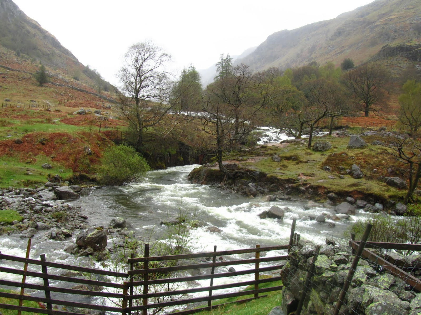
Central Fells and pay Sergeant Man a visit. This walk was a little longer than anticipated, and something else that was decidedly unexpected was the GPS running out of batteries! Fortunately the route was fairly straightforward, over Brownrigg Moss and along Mere Beck.


I think at this point we were possibly thinking it might have been a nicer walk over Steel Fell, as the weather threatened rain. We were also the only people on this path along the beck, possibly because it wasn't the most spectacular of walks. Anywhere else and this would be a popular walk but in this centre of the Lake District, there is just too much competition.


It didn't take us long to reach the summit of Sergeant Man, the second highest of the Central Fells. The wind had picked up a little so we didn't linger, heading down the steep path that would take us past Eagle Crag and onto the boggy ground towards Easedale Tarn.


Although it was getting to late afternoon, we passed a lot of people who were heading up into the fells, surprisingly as there wasn't a great deal of light left in the day. Easedale Tarn is a beautiful setting and from here the walk back down towards Grasmere was excellent as we walked beside Sourmilk Gill before heading back into the village.


Friday, 12 July 2013

Ullscarf from Rosthwaite via Greenup Edge

This walk was undertaken as part of the Wainwright Society's 2013 Challenge. The idea was for society members to walk the Coast to Coast path, and to make note of any damage to the route - blocked gates, inaccessible footpaths and that kind of thing.


Whilst there was no structural damage to the route, the day we chose was so incredibly wet that much of the path up to Greenup Edge was under water and especially the final climb up beside Lining Crag was like walking up a waterfall!


We parked up in Rosthwaite and the walk along the valley floor is a delight, following Stonethwaite Beck upstream with Eagle Crag looming ahead. We crossed a few streams as we headed up and as we made the junction of the Coast to Coast and Cumbria Way, we saw a bunch of bedraggled looking folk carrying canoes, the water seemed far too turbulent to try and ride!


From here the path continued its climb up and the views back along Borrowdale were opening up. Fortune was on our side too as the rain finally started to ease off, perhaps a little late as we were well and truly drenched by this point with feet soaked from the various streams we had to cross.


The scenery completely changed when got past the waterfalls of Greenup Gill, and all of a sudden we were in a huge upland basin, surrounded by the flanks of High Raise, Sergeant Crag and Ullscarf.


The climb up alongside Lining Crag was where we encountered the next watery hurdle and in fact here we had to rescue a lady who was stuck! She was doing the Coast to Coast and said this was the toughest section so far. Once we had seen her to safety she thanked us and told us she was very much looking forward to a large cocktail in Grasmere!


Once past Lining Crag we completed the challenge walk with a trudge through the marshy land to the top of Greenup Edge. With the rain and wind lashing our every step our plans had been to simply go up and right back down, but as the path up had been pretty treacherous we decided to descend via Watendlath, meaning we had the chance to take in a Wainwright summit.


Not that you have to twist my arm to do that. Sights set on Ullscarf, we set off across the very marshy upland, making big detours around the large amount of water that had accumulated. We had some pretty incredible views from what is meant to be the most central point in the Lake District.


Ullscarf is one of those fells that looks quite impressive from below, but the summit is a large fairly featureless  windy plateau and on this day was not a place to linger.


We headed down past Blea Tarn, along a path that although indicated on the map was not present, as we passed from one bog to the next piece of waterlogged ground. The GPS told us we were on course, but it wasn't until we were directly above Watendlath that we joined anything resembling a real footpath!


The climb down to the picturesque farm and tarn was steep, and the promise of a cuppa at the bottom was thwarted as the tea shop had just closed!


By this point the sun was out and we were drying off nicely, so the last mile or so back to Rosthwaite was a real pleasure with fantastic views all the way.


Here we made it five minuted before the tea shop closed and so could reflect on a great walk, sat in front of a fantastic view of Borrowdale, with a cuppa and a smile.