Saturday, 30 November 2013

Buckden Pike, Wharfedale


After our walk up Great Whernside from Kettlewell, I was keen to get back into Wharfedale and hopefully this time with better visibility than the whiteouts we had on that particular walk. That walk up Great Whernside was part of our training for the Yorkshire Three Peaks and this time, our hike up Buckden Pike was a prep walk for the Lyke Wake Walk.


For some reason the drive over the tops into Wharfedale seems to take you through several climate zones and this trip was no exception, as we drove through rain, sunshine and thick fog at various points on the journey.


We parked up in Buckden before heading upwards onto the fell. Weather conditions weren't great as we set off, with the drizzle soon giving way to misty rain as we entered the cloud. Unfortunately this also meant the views were very restricted. The walk up Buckden is nice and straightforward with a good footpath all the way up. Before we knew it, we were at the summit cairn an trig point. Sadly we could still barely see ten metres or so away.


From the summit we headed alongside a drystone wall, towards a memorial commemorating the loss of lives of a Polish bomber crew.


You can read the full story here: http://www.buckdenpike.co.uk/mainstory.html. The path wasn't too bad along here, but once we were past the memorial it deteriorated significantly and at times we were ankle deep in bog. Good training for the Lyke Wake Walk then!


At least it wasn't a long stretch across boggy ground and we soon started our descent of the fell. With the height lost came visibility gained and Wharfedale started to open its heart to us.


You've got to hand it to the Dales, whether you are on rugged limestone pavement, whalebacked fell tops or at the valley bottom alongside river, there is always a serene beauty to the region. The descent down into Starbotton was pure pleasure with a great view of the lush valley and the river.


Our route took us through the idyllic hamlet and out the other side as we headed towards the river, and onto the Dales Way footpath. We stopped for lunch beside the river.


As we were enjoying sandwiches, we noticed a distinct, distressed sound in the distance, and on looking around we could see a sheep with its head stuck in a fence. Unfortunately it was on the other side of the river! Dave bravely took his walking boots and trousers off and hopped into the icy waters, but it was too deep to risk crossing. Let's hope the farmer did the rounds later that day and rescued the poor thing.


The rest of the walk back to Buckden saw us follow the path meander its way gently close to the river. We were soon back at the car and despite the poor visibility we had for the first half of the walk, this was another fantastic expedition into the heart of the Yorkshire Dales.


Monday, 18 November 2013

Raising Money on the Lyke Wake Walk

Once again, the North York Moors challenge walk has drawn us in. Yes, it's the Lyke Wake Walk. The last time I completed this challenge the last few miles seemed to pass in a delirious dream, the only thoughts in my mind were to make it to the end, and promising myself never again!


Well the human works in mysterious ways and so we find ourselves poised to undertake the challenge once again this coming weekend. The chosen charity this time round is the Hardcore Help Foundation. You can read more details including how to donate here.


Friday, 15 November 2013

Wensleydale Ales

I have been lucky enough to interview Geoff Southgate who, along with business partner Carl Gehrman, recently took over the Wensleydale Brewery based just outside Leyburn. You can read the full interview here:

http://massmovement.co.uk/hops-barley-brewers-tale-wensleydale-brewery/

I recommend you settle down in a comfy chair with a glass of Semer Water Light Ale and then enjoy what Geoff has to say!


Friday, 1 November 2013

Walking on the Coastal Cleveland Way


Although we have made the occasional visit to places such as Saltburn and Whitby, we haven't really explored the North Yorkshire coast in much depth. Following a recent excursion to Staithes, we decided this was a place that warranted further exploration, and so Claire and I booked ourselves a night away in a beautiful little cottage just off the sea front, and a coastal circuit walk with our partner in crime Dave.


Our chosen route would take us in a loop, following the coast southwards before heading inland for the return leg. Seeing as the harbour village of Staithes is tucked below steep cliffs all around the walk started with an inevitable hike upwards, taking us onto the Cleveland Way.


This was just a short ascent though and the rewards were fantastic - from here on the coastal walk was pure pleasure with massive views out to sea.


Looking back we could see the massive cliffs that protect Staithes from the elements. Soon enough we passed Port Mulgrave which has a fascinating mining history. I am sure we will be investigating this part of the coast at some point in the future but for now we pushed onwards until we reached Runswick Bay.


So Runswick Bay - how come I had never heard of this place before?! Aside from the picture postcard village, it boasts a fantastic beach. Conditions were so nice that Dave and I agreed if we had our swimming gear with us we would have gone for a dip - had we brought our trunks I am sure we would have found an excuse not to go in though.


We spent a bit of time on the beach, enjoying the incredible bay and lovely conditions before heading back up to the higher ground along the cliff tops to Kettleness where we stopped for lunch. I think we could have sat there for hours enjoying the views, but we soon pressed on.


The return leg of our walk saw us come away from the coast, following the bed of an old railway track. In order to get there we had to cross a field with an angry looking bull that stared at us the whole time we were in "his" field - we gave him a wide berth!


The rail path took us back to Runswick Bay and here again we swung away from the coast, following the road to Hinderwell and crossing a couple of fields before entering the woodland of Borrowby Dale.


This was a day for lots of varied walking terrain and all of it interesting, but the coastal paths were the definite winners.


The last half mile or so saw us return to Staithes past the row of houses at Cowbar, and this gave us a really spectacular approach back into Staithes and a welcome cold drink at the Cod & Lobster right on the sea front.


An amazing day's walking that really showed off the versatility of the North York Moors and the Cleveland Way.


Friday, 25 October 2013

Lake District Ales

I can't recommend drinking a beer on a walk, but after a hard day's walking I can't think of a better reward that a pint of Lake District ale in one of the Keswick pubs.


The second best option is to take that taste of the Lakes home with us, and during a recent stop off in Glenridding I picked up on a few choice ales that don't have many stockists.


In particular the Ulls-Water is a custom-labelled beer from the Keswick Brewing Company that is only available in Glenridding.


The Ulls-Water is actually Thirst Ascent in disguise, but I do like those custom beer labels. I'm really waiting for a special occasion to crack these beers open, although having said that, I might have the odd one or two in the meantime, be a shame not to - Cheers!

Sunday, 13 October 2013

High Street & The Far Eastern Fells

Into The Unknown...

I had only previously done one walk in the Far Eastern Fells, and seeing as it was a simple enough circuit up Wansfell from Ambleside, it felt very central and not at all as if I was in the wilds of the Far East! And as we are normally based in Keswick or Ambleside when walking in the Lakes, this is always a bit too much of a trek.


Anyhow one Saturday we set off early from home, grabbing a quick tasty breakfast on the A66 at the Llama Karma Kafe before talking the scenic route along the shores of Ullswater, through Glenridding and Patterdale before parking up in Hartsop.


Our chosen route was well defined and trouble-free, essentially following the valley up to Hayeswater reservoir, before hitting the high ground, following the long arching top of High Street, with the occasional diversion to grab one of the neighbouring summits.


The walk along the valley was gorgeous, with Hayeswater Gill babbling alongside us and the sun high in the sky as we headed up towards Hayeswater. I did have a slight "Wainwright moment" - you know when other people are walking, at more or less the same pace as you, but you'd rather walk alone? So you stop every now and then to let them get ahead, but a couple of minutes later they have a rest as well, so you keep catching up and the usual awkward smiles and small talk ensues... I digress.


We headed straight up the steep grassy slope that would take us onto the old Roman ridge, meeting up with the path and wall that travels in a remarkably straight line from Rest Dodd up to The Knott.


Once we had made it onto the higher ground and the High Street ridge, that was it, the hard work was done. All that remained for the next couple of hours was to wonder around the plateau, ticking off summits and making High Raise, Rampsgill Head, Kidsty Pike and even High Street some of the most straightforward Wainwrights I've tacked so far. The views were far reaching, and from Kidsty Pike we had a glimpse of some deer down in Riggindale below.


We enjoyed our lunch on the wall on the summit of High Street, with views all the way to Morecambe Bay, as well as the bulk of the Lake District fells. Sometimes perspective plays funny tricks on the eyes, as the Coniston fells looked much closer than they ought to be. High Street summit reminded me of Whernside, with the wall marching on relentlessly along the whole ridge.


The next summit of Thornthwaite Crag was clearly identifiable as was the route which followed the path of the ridge curling round to the imposing summit cairn. As with the previous summits this was a straightforward but rewarding walk with views of pretty much the whole of Lakeland and its iconic fells.


Thornthwaite Crag was pretty busy so we didn't hang around, pressing on instead down a ridge over Grey Crag that would bring us back down towards Hartsop. This doesn't appear to be a popular fell, and we had the place to ourselves.


Maybe it is off the popular beaten tracks, but it was nice to have a bit of solitude. The map and guidebook were both a little vague when it came to the route off the fell and back down into the valley, so we had to make up our own route, straight down the grassy flank of Grey Crag.


After that leg-burning descent we were glad to get onto the more gentle gradient of the footpath along Hayeswater Gill and back to the car.

Thursday, 26 September 2013

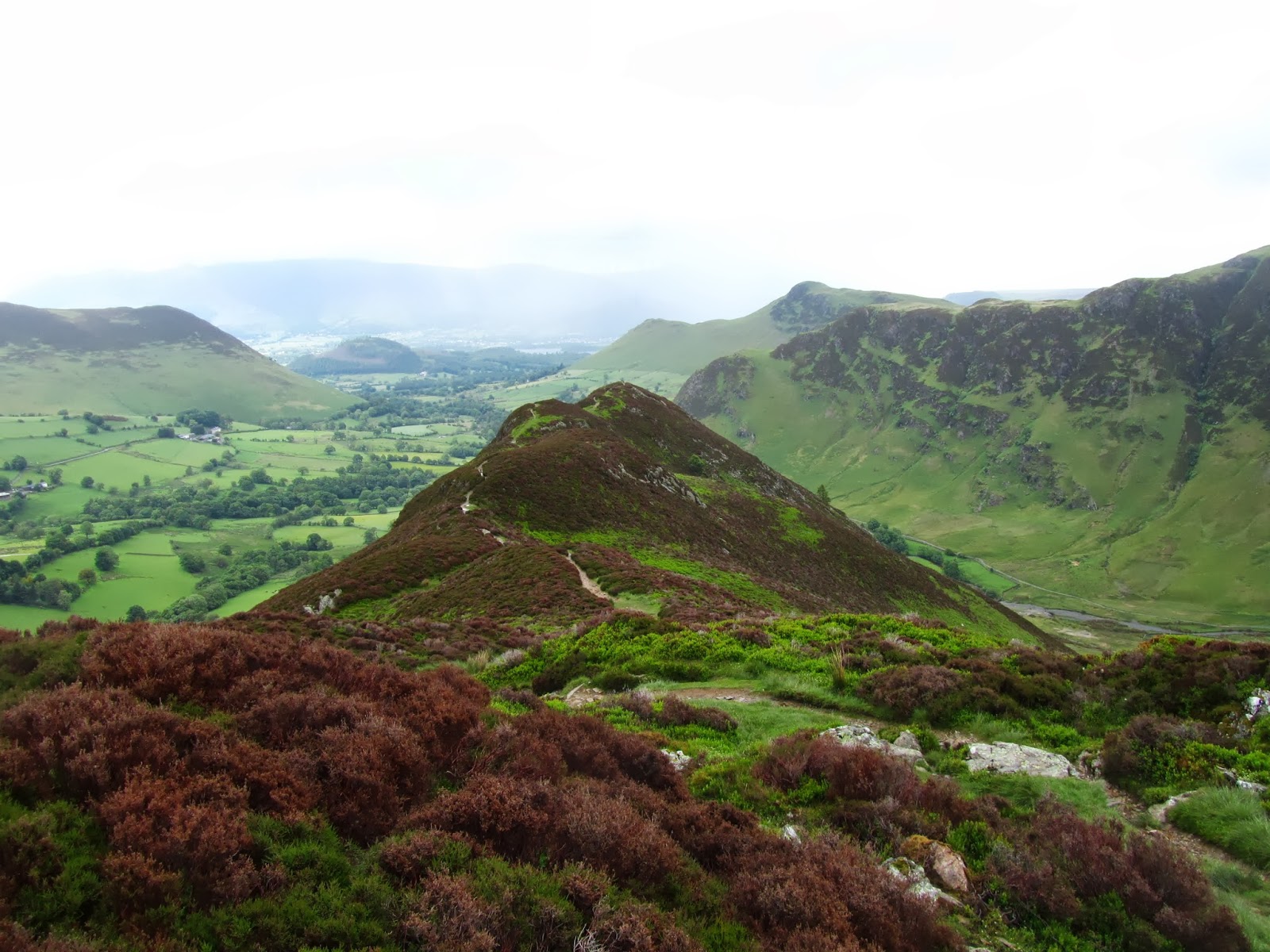
A Newlands Round, North Western Fells

The Newlands Valley has to be one of my favourite parts of the Lake District. A stone's throw from Keswick - or a stone skim if you are going right across Derwentwater.
On a recent Summer's day Claire and I were in Keswick, but it was one of those rare days this Summer when the weather looked like being truly awful.


We were outside Moot Hall wondering if it was even worth setting off, but we soon decided that even in the pouring rain a quick hike over to Grange on the other side of the Lake would be a nice trip out.


By the time we had got to Swinside the weather had improved considerably and so we soon set our eyes on the Newlands fells ahead of us. Instead of starting with the usual Catbells, we decided on coming round the back way, starting with Hindscarth.


Walking around the lower slopes of Catbells and Maiden Moor, this all meant we had already walked six miles, in order to get to the start of the walk!


The pull up to Scope End is steep and gets the blood pumping, but it is also a quick way of gaining altitude and as always, each step upwards is rewarded with an ever increasing vista. We could see the clouds shifting and shafts of sunlight to the north of us on Causey Pike.


Once you've done the hard work the next section of the walk is a real pleasure, a ridge route that takes you all the way to the summit of Hindscarth. After the fairly narrow ridge the summit is quite vast, with clear routes in a couple of directions. It was pretty windy on the exposed top so we didn't linger, but headed straight towards the next summit of Dale Head. The wind didn't let up and we were grateful for the wide terrain, rather than having to worry about being blown away.


As we reached the main path to Dale Head we had some great views over the back of the Newlands Valley and into neighbouring Buttermere and it's collection of fells, and a good view of Fleetwith Pike.


Over the other side we had an incredible view down into Newlands, over the vale of Keswick and the Skiddaw massif in the distance. Dale Head has a fantastic cairn marking its summit, but the wind had not died down in the slightest so once again we didn't hang around.


The ridge route from Hindscarth to Dale Head had been a nice easy one along Hindscarth Edge, but the onwards path to High Spy meant a steep slope down to Dale Head tarn and a sharp climb back up, but once we lost a bit of height we found some welcome respite from the wind. We had done High Spy a few years ago from Catbells and so we were now back on familiar territory.


Walking in this direction meant we had the view of Keswick beyond Derwentwater accompanying every step. It is an easy walk from High Spy to Maiden Moor, but by now we were conscious of time - having only intended to do a short walk we had not set out especially early and by now it was late afternoon. We decided to skip Catbells, coming back down onto the path near Little Town past various disused mine shafts, workings and levels that reminded us that this used to be very much a working landscape.


By now we had missed the last boat back across Derwentwater and the last couple of miles back to Keswick meant we had done about 18 miles - not bad for a short walk!