Monday, 28 July 2014

Lyke Wake Walk June 2014

Regular readers may recognise a theme. But this is not a repeat, but a tale of another crossing of the North York Moors legend that is the Lyke Wake Walk. Our third crossing in eight months no less. As with our previous two crossings, Dave, Claire and I chose not to use a support party, carrying all our supplies as well as stashing some bottles of water on the moors for later.


For me this was the first Summer crossing, having previously done  the walk in decent to terrible Winter weather. This time around, conditions were pretty much perfect. We picked the longest day of the year, on a decent but not too hot day, after a relatively dry spell.


We set off on Friday night at abut 9:45pm from Cod Beck reservoir just outside Osmotherley. We missed out on a photo at the LWW stone as a large walking group decided to hold a meeting there before setting off on their own expedition. It wouldn't have hurt to move over and let us have the stone for a minute, but these guys weren't about to budge, and so we set off, having a good old moan right from the outset.


I have to say it was a real joy to start the walk in daylight. Not only could we see where we were going, but we were soon treated to a beautiful sunset. There aren't many occasions when Teesside gets described as attractive but this is definitely one of them.


Shortly after we were heading up the first of the Cleveland Hills, making the steep climb up to Live Moor and onto Carlton Bank. By now the light had failed and the headtorches came into action. It was fairly cool for the time of year, ideal walking conditions. We grabbed a bite to eat at the trig point of Carlton Bank before heading down and back up Cringle End.

When we passed the Lord Stones site, we could hear the merriment of people headed home after their night out, but our night was only just starting. We had an interesting moment as we headed towards the Wainstones, walking through a field of cows that were eerily silent as they watched us tramp across their patch. The Wainstones were spectacular even in the dark and this is definitely a place to explore independently of a LWW crossing.


After the Wainstones and the next hill Hasty Bank we had the long steady climb up Urra Moor over Round Hill and over to Bloworth Crossing, before getting some speed up on the railway track. We took the "new short cut", cutting onto the moors to our left over towards Ralph Cross, rather than following the track to the Lion Inn. Although we did lose the path here and there, this was definitely a good time saver. By now the sun was coming up for what promised to be a glorious day.


We stopped for some food at the foot of Fat Betty, before heading along the road to meet the boggy section....


Which was about as dry as you can get! The peat bog was bouncy, pleasant underfoot and great fun to cross. There was the occasional marshy patch and I don't think that the pond not too far from Shunner Howe will ever dry out, but this section was a real highlight of the walk as it was so easy to cross.


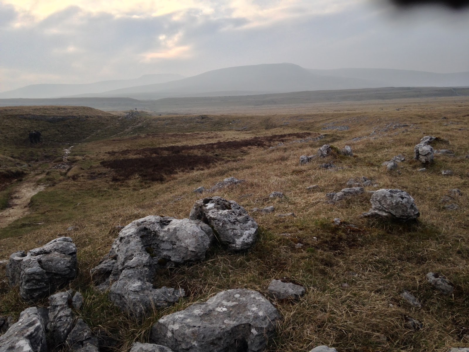
The dry ground continued over the road and the path up to Blue Man I' th' Moss was fine too. After Blue Man, it does get rocky making this section possibly the most challenging terrain under foot. The views open right up over towards Flyingdales, but it is a little deceptive as what looks like a fairly flat vista ahead of you hides the fact that Wheeldale is just ahead.


This deep little valley is very scenic, but hard work, with a steep climb down to the stepping stones over Wheeldale Beck. I took the opportunity to take my boots and socks off to dip my feet into the Beck and this was an amazing sensation, totally refreshing. With the sun on our faces and a nice sandwich, this was a beautiful place to stop for a breather.


But the LWW wasn't anywhere near done with us and so we made the steep ascent up to Simon Howe. In the past this has felt like a hard slog - especially when the bank up is wet and slippery, but this time it didn't hurt quite as much. When we get to Simon Howe it really feels like you are well over the halfway mark, and for me this is quite a motivator - all of a sudden the Fylingdales monster isn't a speck in the distance but right there a mile or two ahead.


A look at the clock told us that we were making excellent progress and that also meant that we would get to our pub and hostelry in good time - that's pretty much all we needed to spur us on.There were quite a few people at the layby at Fylingdales a mix of support parties and rail enthusiasts. Just over the road, for an unexplained reason there was a man asleep near the RAF boundary fence. Definitely an odd place and time for forty winks!


The newly cleared path up alongside Little Eller Beck made the section up to Lilla Cross nice and straightforward - the last thing you need when you are exhausted is to go and get lost waist deep in heather!


The dry weather also meant that the rough terrain beyond Lilla Cross was not the heavy wet nightmare that it can  be, but at this point fatigue was setting in and made this section the toughest and dullest part of the walk.


You would have thought that the steep ravine of Jugger Howe that follows would be hell but somehow I don't mind it. I love the scenery here, plus the knowledge that the end is more or less within reach makes it not feel so bad.


However once the ravine is crossed, there is some tough path and road walking to be done and at this stage I knew there were some blisters coming into play. We hit the A171 road, knowing that we only had another couple of miles to go, and that there was a nearby pub with soft beds and cold beer awaiting. Although this last section was quite a killer for myself and Claire as we had both amassed a fair old collection of blisters, it was still a celebratory climb up to the mast.


Sixteen hours and five minutes after setting off from Osmotherley we had once again completed the Lyke Wake Walk, with plans for the next crossing already hatching.


Thanks again to my long suffering partners in crime Claire and Dave. Always a winning team!

Saturday, 12 July 2014

Yorkshire Three Peaks, Spring 2014


And so the lure of the fells around Horton In Ribblesdale reached out to us once again, more or less a year since our last Three Peaks. Claire and I found ourselves parked up at the Ribblehead viaduct early one Spring morning, waiting for our challenge walk partner Dave to roll in from Leeds. This was our first walk together since our epic Lyke Wake Walk challenge but I think out boots had only just finally dried out!


We set off in beautiful conditions, and made quick progress up the lower slopes of Pen-y-Ghent. The ground underfoot was fairly dry at this point, which was a new sensation after our last walk. Pen-y-Ghent is a great way to start the challenge as the short sharp ascents conquered fairly quickly, and so you start thinking "one down two to go" early on in the walk. There has been extensive repair work done to the path approaching the summit, and whilst the stone slabs looked very new and somewhat out of place/ character, it is definitely a necessity, to help the fells cope with the thousands of boots stomping up and down the route each year.


The Three Peaks are great walks individually and whilst I enjoy the challenge of the walk, I am keen to come back and explore some of the other attractions Pen-y-Ghent has to offer, in particular Hull Pot.


For some the walk from here to Ribblehead is a long dull trudge but I feel it gives you a chance to relax and feel as though you become a part of the bleak yet beautiful landscape. The footpath restoration work here is a little older and has started to blend in well with its environment, although it got very muddy at times and we were quite glad to have tarmac under our feet for the last section to the viaduct where our supplies awaited as did a van selling cups of tea, and with a steam train crossing the viaduct as we approached, the image was complete.


Whernside is a bone of contention for many as the long whaleback of a hill feels like it takes an eternity to climb. With Pen-y-Ghent and Ingleborough you have a short but intense ascent that sees you hit the higher ground fairly quickly, but Whernside likes to take its time. Slowly but surely it saps the energy from your legs as you gradually gain altitude. This time around, this section actually flew by, it's amazing what good company can do to you, and before we knew it we had crossed the narrow gap in the wall to put our feet briefly on Cumbrian soil and admire the OS trig point.


Although we never set out on these challenge walks with the expressed intention of beating previous times, we were making good progress. As with the climb up, the descent of Whernside had not been especially pleasant on previous occasions, as the steep zig zagged path really starts to jarr on tired knees by this point, however once again this felt like a breeze. Whernside, your kindness has been noted.


We were on good form as we crossed the road and hit the lush pastures that lie at the feet of Inglebrough. I think this is possibly my favourite part of the walk with majestic Ingleborough in your sights as you cross farmland. The rich green farmland is criss-crossed with drystone walls and peppered with limestone outcrops that make this scenery so special and immediately recognisable.


The trees that manage to eke out a living deep in the limestone crevices are a wonder unto themselves, as well as being an amateur photographer's dream. Take a picture of these survival experts and it seems to always look great!


Eventually you reach the bottom of Ingleborough having exchanged a knowing nod of anticipation with any resting walkers, as the amazingly steep path ahead is clearly defined and at this late stage in the walk, a testing moment.


Yes, it is a real climb, a trial to tired limbs and lungs, but it doesn't go on forever and sooner that you think, you reach a little path of turf where you are welcome to flop down and give yourself five minutes. It is worth catching your breath, as the summit is still considerably higher, leaving you with another climb to reach the vast rocky plateau that is the top of Ingleborough. Although normally a lovely place with amazing views, it was fairly hazy today and with a cold wind biting, we headed off fairly quickly.


For me, this last section is the real killer.You feel like you have really completed the walk, hiked for many hours, and actually climbed the Three Peaks. Not so. A good few miles lie ahead and on tough terrain. Slippery limestone, thick mud and some moody, sturdy looking cows have still to be negotiated.


But this is part and parcel of the walk. A desire to complete this majestic circuit on your own two feet mean you have to cover the ground carry out and the legwork to reap the rewards, and these last miles are the final piece of the puzzle.


Finally we made it back to Horton, and as we crossed the railway tracks at the station, smiles broke out all round as we had made good time on our circuit and once again became part of an incredible Yorkshire Dales experience.

Sunday, 29 June 2014

Little Mell Fell: The Lake District Lowlands

I guess as part of attempting to tackle ALL the Wainwrights, you have to take the rough with the smooth. Or in this case, the smooth and rounded instead of the rough and craggy.


Some of these "minor" fells are also valuable for a number of reasons - they are easily done in a shorter amount of time, and a good number of them lie on or close to our route when headed home from the Lakes. Great Mell Fell, Souther Fell, High Rigg, Latrigg are all fells we can easily head up on the way home and one other obvious addition to this list is Little Mell Fell.


True, a walk up Little Mell Fell cannot compare with the thrills of a high ridge walk, an ascent of a higher fell, or a grand day out. It is lowly, rounded, grassy and isolated from other fells.


But for me it is the gateway to the Lakes, the first bump in the landscape that tells you that you are entering Lakeland. It is also a nice quiet corner of the Lakes and so the lanes between the A66 and the shores of Ullwater provide an ideal little network of routes for cyclists to avoid the busier roads.


Our tour of Little Mell Fell was completed in under one hour - ascent, enjoy the view, and descent. There's no description of the route needed either. Park at the bottom, head upwards on the grassy slope until you reach the trig point, then head back down.


I did really enjoy the landscape from here. The great hulk of Blencathra over to the north, the fellow minor fells of Great Mell Fell and Gowbarrow Fell nearby, Ullswater just beyond and panoramic views of the Lake District to the west and the Eden Valley over to the east.


All in all an easy and fun little walk that allows us to get just that little piece more of Lakeland before heading home.

Sunday, 22 June 2014

Walk To Work on the Coast To Coast


I recently heard of a walk to work week initiative, and this gave me the perfect excuse to trek a section of the coast to coast, since my office is very close to the route!


It was a simple enough walk from Richmond to Colburn, a distance of about 4 miles each way. Whilst this section of the C2C is not as spectacular as some of the others, it is pretty and has a charm of its own.


Leaving Richmond Station along the old railway path, you catch glimpses of Easby Abbey through the trees. Shortly after the C2C leaves the rail path and climbs through fields to a patch of woodland on the banks of the river Swale.


This is a lovely little woodland walk and at this time of year the scent of wild garlic was heavy in the air.


As you climb out of the woods and back into fields and farmland there are occasional glimpses across valleys deep into the Yorkshire countryside. Soon enough I reached the charming village of old Colburn and the end of my walk, only to enjoy the same route in reverse at the end of the day.


Who would have imagined that the commute to work could be so good!


Saturday, 7 June 2014

The Fairfield Horseshoe

I gaze upon the Fairfield Horseshoe every time we stop off in Ambleside. As you look northwards from the town, the Fairfield group of fells are displayed in their full glory, inviting you to take on the circular challenge.
A few years ago, myself and crag rat Rainer made a tentative venture onto these fells completing a half-circuit. We started off with a steep pull up the scree slopes of Fairfield before working our way back down along the eastern flank.


This time around with a full day of walking ahead of us, an excellent weather forecast and a table booked at Zeffirellis for the evening, conditions seemed perfect to tackle this walk. We opted for an anti-clockwise route, setting off from Ambleside and starting with Low Pike. At this point we had glorious sunshine, with just the hint of a breeze to keep us fresh.


As we made our way up the slopes of Low Pike, the wind gradually picked up, but we still enjoyed its cooling effect and it helped us on our climb. Despite its name, as it's name suggests, this is not the highest of fells, and although easily reached, it is quite a sharp pull up, as you get onto the main ridge of this wonderful circuit.


From here navigation is made very simple by a dry stone wall that traces the route for the next few miles. This does restrict views somewhat looking forward, but with an increasing wind, it made for welcome shelter.


Clouds started rolling in, and it seemed that the weather forecast might have omitted some of the facts! The walk up from Low to High Pike is very impressive, with the next goal in clear sight as you gain altitude.


From here, much of the hard work has been done for now, as the path and accompanying wall march onwards over the summit of Dove Crag - which was the subject of the first ever chapter Wainwright wrote for his Pictorial Guides.


Somewhere along here, our faithful companion and wind shelter slowly dwindled away, leaving us exposed to the elements. The next fell on the horseshoe, Hart Crag is a short walk away, but by this time the clouds were rolling in. From here you have  choice to either continue towards Fairfield, or an alternative would be to head eastwards to Hartsop Above How and then down towards Brothers Water.


We pressed on towards Fairfield, at this point the winds were getting much stronger and we felt a few drops of rain - what happened to the weather forecast we were promised?!?! Conditions on the vast Fairfield summit platform were pretty bad so the camera didn't come out much except to take this shot down back into the valley.


We had planned on stopping for lunch, but after visiting the summit cairns and shelters we decided it would be better to head for lower ground, so on we marched onwards on the return leg of the horseshoe.


This is a very spectacular ridge and it's not hard to see why it is so popular, but today things were very quiet up here with the howling winds, and its fair to say we were glad it was a wide ridge rather than a narrow crest of rock!


Onwards and over Great Rigg and Heron Pike and there was no let-up, so not much of a chance to stop and take in the views.


Even on lowly Nab Scar we still had a howling gale to contend with, but we did manage to find a spot of shelter for lunch.


Soon enough afterwards, we were back down off the higher ground on the valley floor, where we stopped at the very picturesque tea shop at Rydal Hall for a warming cup of coffee.


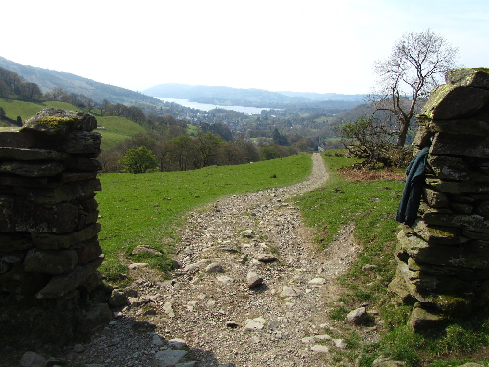
The walk back to Ambleside route is a really nice lower level walk, and the perfect end to a spectacular if at times a rough day on the fells.